SIGN UP FOR MY EMAIL TO RECEIVE YOUR FREE SAN FRANCISCO PLANNING GUIDE.
- Home
- Things to Do in SF
- Lands End
Lands End SF - Hiking Trail, Parking, & Other Tips to Visit
By: Jill Loeffler • Updated: March 10, 2025 • Published: March 4, 2022
Lands End SF is one of the most popular hiking trails in the northwestern corner of San Francisco. It offers stunning views of the Golden Gate Bridge, the Marin Headlands, and the city skyline.
The Coastal trail is also full of hidden secrets, like secluded beaches, abandoned shipwrecks, and old army batteries.
In addition to being a beautiful place to hike, it is also where you will find the Legion of Honor, a cliffside labyrinth (at times), Sutro Baths, and some war memorials.
Most of its attractions are hidden among its thousands of trees, but each one is worth your time to explore.
If you're planning to visit Lands End, check out my complete guide below. I'll cover everything from the best time to go, what to bring, and where to park.
SFTourismTips is made possible by readers like you! If you book through my links, I may earn a small commission—at no extra cost to you. Thanks for your support! Learn more.
Table of Contents
- Where to Go Hiking
- Where to Enter the Lands End Trail
- What to Bring on Your Hike
- Best Times to Visit
- Weather at Lands End
- Shipwrecks
- Lands End Labyrinth and Lookout
- Mile Rock Beach
- Lincoln Park
- Sutro Baths
- Cliff House
- Other Things to See Here
- Restaurants Nearby
- How to Get Here
- Parking Options
- History
- Is it Worth a Visit?
Hiking Along Lands End San Francisco
Lands End SF sits on the northwest side of San Francisco. It's part of the larger California Coastal Trail, a 1,230-mile trail between Oregon and Mexico. This gorgeous, free hiking trail is adored by both locals and visitors.
It’s a 3.5-mile loop trail with a few different additional paths that allow you to extend your hike. These small paths off the main trail lead you to fantastic views, war memorials, old army batteries, and hidden beaches.
These include a hike down to Mile Rock Beach, the Lands End Lookouts (there are two), and Point Lobos.
If you plan to add these extra pieces to explore, you could increase your hike to 4.5 to 5 miles. I'll explain more about the different places to stop and explore below so you know a little more about what to expect when you arrive.
This hiking trail is so popular because it has fantastic views as it skirts along the rocky cliffs above the Pacific Ocean. It’s also away from the chaos of the city and gets your heart pumping.
How long does it take to hike the trail? Most people spend about an 1.5 to 2 here. If you decide to explore some of its attractions that are slightly off-path or stop at several memorials and overlooks, you could spend at least 3 to 4 hours on the trail.
Can you see the Golden Gate Bridge from Lands End?
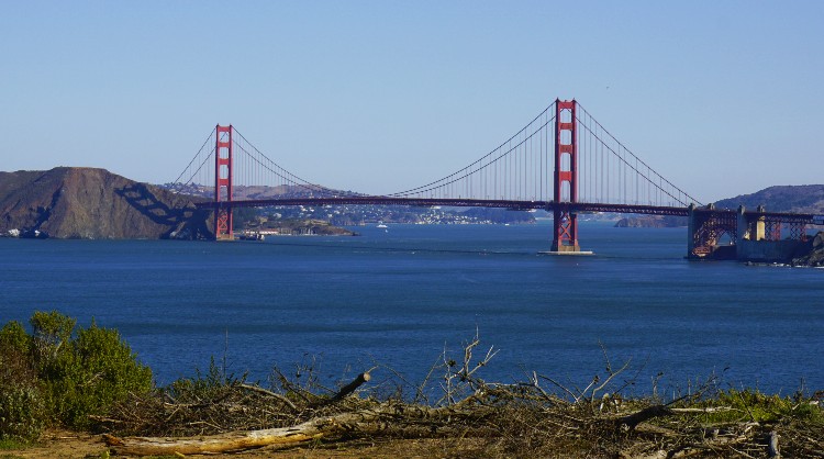
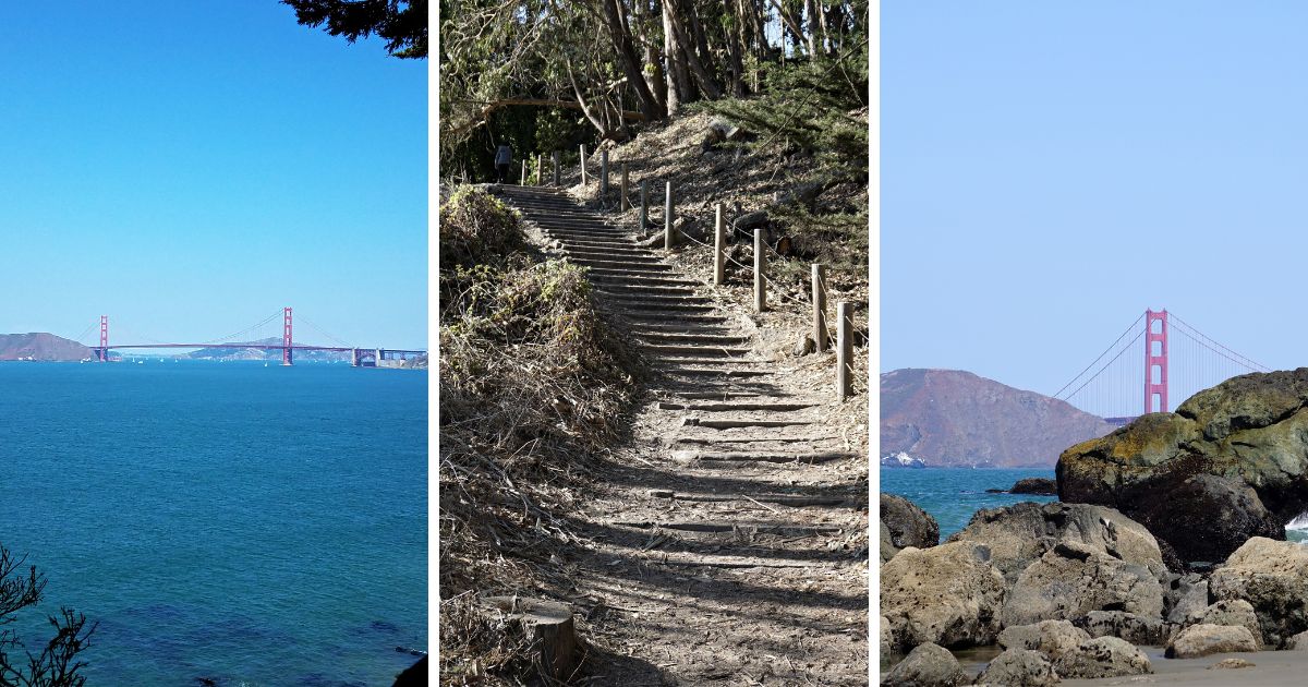
Lands End is an excellent place to see the Golden Gate Bridge. It's one of the best places in San Francisco to get a photo of it! You'll see the bridge peeking through the trees throughout your hike on the trail.
It's one of my favorite places to photograph this popular SF attraction.
Where to Enter the Lands End Trail
There are a few different places you can enter the Lands End Trail.
The most popular place to start is near the Sutro Baths ruins on the western side. You'll want to park in the lot at the end of El Camino del Mar or on Merrie Way, and then walk towards the Visitor's Center.
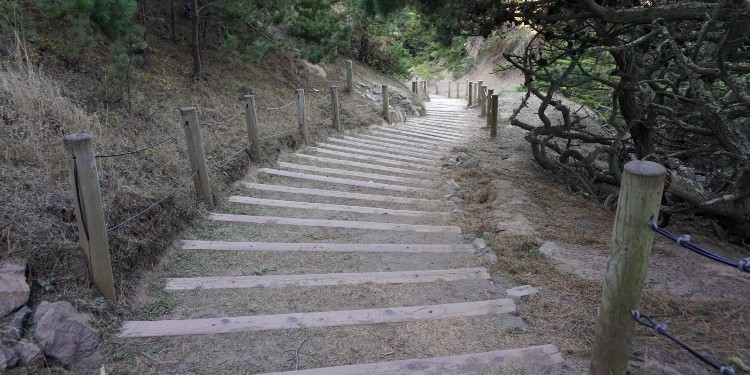
You'll take the stairs down to the walking path and along the cliffs. You can then continue north and east along the dirt pathway.
I suggest starting your hike from here and then making your way east. This will give you the best views of the Golden Gate Bridge as you hike.
You can also start on the eastern end near Sea Cliff and hike west toward Sutro Baths. If you plan to hike this way, you will find the start of the trailhead at Eagles Point, which is near the Lincoln Highway/El Camino del Mar and 32nd Avenue.
What to Bring on Your Hike
You'll want to bring a few things with you on your hike.
First, I recommend wearing comfortable shoes since the trail can be rocky in places. You'll also want to dress in layers since it can be windy and cool near the ocean.
I also recommend bringing water and snacks with you, especially if you plan to hike the longer loop. There are a few water fountains along the way, but it's always good to have your own water supply. The water fountains are usually in working order, but at times they won't be turned on.
Finally, I suggest bringing a camera so you can snap some photos of the incredible views!
Best Times to Visit
When is the best time to visit Lands End SF? The answer to this question depends on what you're hoping to see and do while here.
If your goal is to hike the trail and get some great views of the Golden Gate, I recommend visiting on a clear day. September, October, and April tend to be some of the best times to visit as you will find mostly clear skies during these three months.
You might also get lucky mid-day in the summer too. San Francisco is well known for our summer fog, but it will usually burn off during the day and return at night. If you are head out for a hike after the fog burns off, you will find this area is spectacular.
If you're hoping to see some shipwrecks, you'll need to visit during low tide. I recommend checking the tides before you go so you can plan your hike around this. Try downloading the app Tide Now – San Francisco Bay Tides and Currents. This will give you the latest information, so you will know what you’ll be able to see when you arrive.
Lastly, if you want to avoid the crowds, I recommend visiting during the weekdays. On weekends, this place can get crowded!
What are the hours?
The hours are from sunrise to sundown. Even though there aren't any gates or anything that close the trail down, I highly recommend you only explore this one during the daylight hours.
The main trail sits close to the cliff with, at times, little to no barrier or fencing between the path and the cliff's edge. During the day, you'll have no problems staying on the trail, but it isn't something you would want to try to manage in the dark.
Weather at Lands End
What is the weather like at Lands End in San Francisco? The weather can be unpredictable since it's right on the coast.
I always recommend dressing in layers as the wind can pick up and make it feel cooler than it is along the trail.
Even on days when the sun is out, I always find myself reaching for a jacket when I'm hiking at Lands End! Parts of the trail are also shaded by giant trees, which means certain sections are cooler than others.
In general, you can expect the temperature to be about 10 degrees cooler than it is in the heart of the city.
So, if it's a hot day in San Francisco, you may want to consider heading out to Lands End to cool off!
Overall, be prepared and make sure to wear or bring along layers.
Shipwrecks
Where do I go to see the shipwrecks from land at Lands End San Francisco?
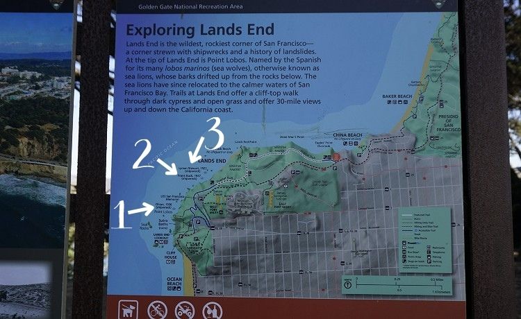
One piece of San Francisco history that isn't as well known is that you can still see three shipwrecks along the trail.
Here is a little more about each one and when and where to see them.
1. Ohioan
The Ohioan is a 1914 cargo ship that eventually was taken over by the United States Navy and used during WWI. In 1919, it returned to its original owners and was used to haul cargo to ports around the United States using the Panama Canal on its journey between the east and west coast of the United States.
In the fall of 1936, the ship was heading to San Francisco Bay. It was a foggy morning, and they were too close to shore. It wrecked near Seal Rocks. In the months following the wreck, they salvaged much of the ship and its cargo.
They left the sternpost and boiler, which you can still see today at low tide.
The best place to see this shipwreck is from Point Lobos.
2. Frank H. Buck
The Frank H. Buck is another shipwreck that you can still see along the trail. It was an oil tanker in service from 1914 until it was wrecked in 1937.
It was another ship taken over by US Navy for World War I.
This ship was headed to Martinez with oil and crashed into a luxury passenger liner, President Coolidge. It was another foggy day, and the ships did not see each other. Both had warning systems that sounded too late to prevent the collision.
The luxury passenger liner had minor issues, but the wreck was fatal to the Frank H. Buck.
They used dynamite on it in 1938 as there were many shipwrecks littering the area. However, the engine and sternpost are still visible.
Today, you can see these pieces at low tide to the west of Mile Rock Overlook.
3. Lyman A. Stewart
The final of the three shipwrecks here is the Lyman A. Stewart. Built in 1914, it was a sister ship to Frank H. Buck.
This oil tanker didn't have as storied of a history as its sister ship. In October 1922, it set off from the San Francisco Bay full of oil en route to Seattle.
It was a foggy day (you can see why there were so many shipwrecks during this time!), and another ship was headed into the SF Bay. Because of the thick fog, their alarm systems weren't loud enough, and the two collided.
Stewart began to sink, the crew abandoned the ship, and the captain tried to steer it to shore. The currents pulled the ship to its current location, which is also where Frank H. Buck ran ashore.
What you can see today of the Stewart is also its sternpost and engine. You'll see this at the same spot as the Frank H. Buck.
Lands End Lookout and the Lands End Labyrinth
The Lands End Lookout is a breathtaking vista off the main trail about halfway through.
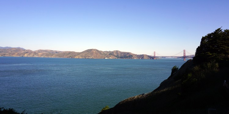
This vista is famous for its unobstructed views of the Golden Gate Bridge, the Marin Headlands, the Mile Rock Lighthouse, and the water between SF Bay and the Pacific Ocean.
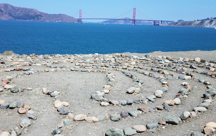
Due to its gorgeous views and the amount of space on the lookout, artist Eduardo Aguilera decided it was the perfect spot to build a labyrinth. He created it in 2004 with rocks from Mile Rock Beach, which is just to the west of it.
Over the years, the labyrinth has been destroyed and rebuilt a few times. Someone destroyed it again during the pandemic. It has yet to be rebuilt.
Two locals decided to try their hand at rebuilding it. They started to carry the rocks up the steps from the beaches below. They quickly learned how hard and time-consuming rebuilding it would be.
They didn't have time to make it happen, so they improvised.
They created a beautiful rock heart that sits on the Lands End Lookout, where the labyrinth used to be.
Will the heart be destroyed? Yes, probably at some point.
Will the labyrinth be rebuilt? I have no idea, but I hope so.
When you visit, you never know what you'll find here.
The worst-case scenario is you arrive and get the chance to soak in amazing views of our famed Golden Gate Bridge.
If you only want to visit the lookout, your best bet is to park at a lot behind the Legion of Honor on El Camino del Mar (use the address 1298 El Camino del Mar to find it).
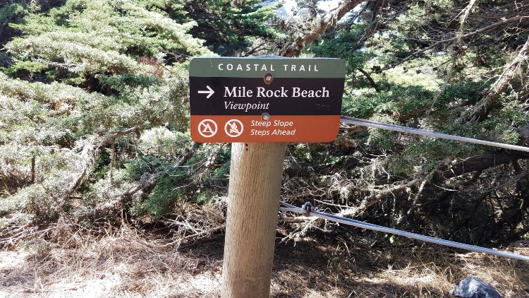
Hop on the trail, take your first right and then take another right. From here, follow the path to the water's edge or until you see the sign for Mile Rock Beach. Walk down the stairs and stay to the right. This is where you will find the lookout (and hopefully the labyrinth or the new heart).
Are there two Lands End Lookouts? Yes. Both the viewpoint where the labyrinth sometimes sits, and the Visitor Center, use this name. The location of the labyrinth is officially called Lands End Point, but it's rarely referred to by that name. Make sure you know which one you are looking to visit before you arrive, as they are about a mile apart.
Mile Rock Beach
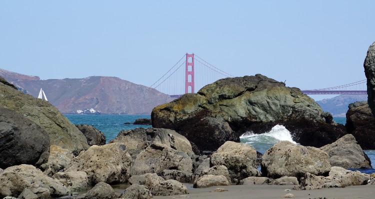
You will find this cozy beach to the west of the lookout. It's famous for its stacks of stones, some with colorful and interesting graffiti.
Mile Rock is one of my favorite places to explore as it's never really too busy.
You can also get some stunning images of the Golden Gate Bridge and the Marin Headlands.
To get here, follow the instructions above or watch for the sign shown above in the picture.
Once you finish the first set of stairs, head west (or take a left) down the steep stairs. This set of stairs will take you down to it.
Lincoln Park
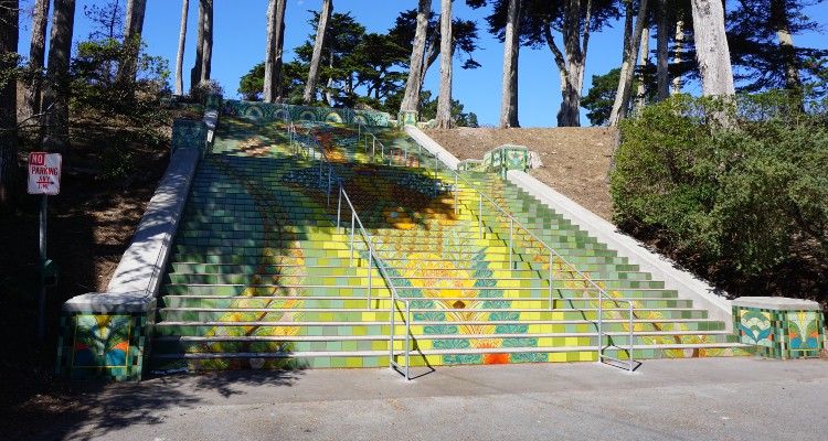
This 100-acre beautiful park sits just south of Lands End San Francisco. Inside the park, you will find a lovely golf course, the Legion of Honor, and a set of colorful mosaic steps.
You can't tell the boundaries between Lincoln Park and Lands End, so you might walk or drive through it on the trail.
If you get a chance while you are here, head over to where California Street ends at 33rd Avenue and check out the mosaic tile steps.
Sutro Baths
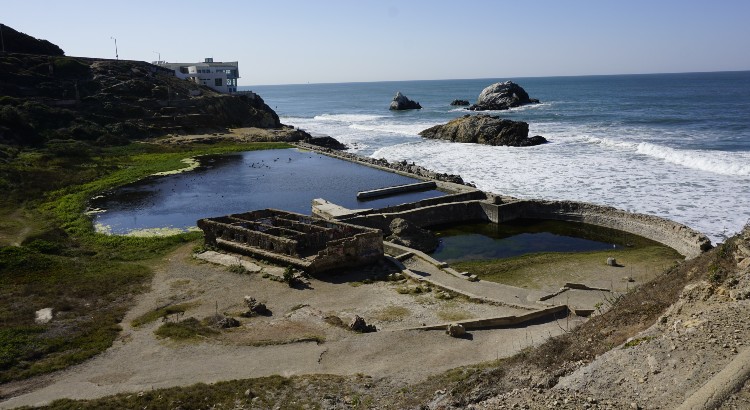
Another popular spot to visit here is the Sutro Baths. The history of the Sutro Baths started in the late 1800s when they were built as an indoor swimming complex.
The Sutro Baths were one of the largest indoor swimming pools in the world and could accommodate up to 2,000 people at a time.
The baths were open for almost 100 years and closed in 1966 after a fire burnt them to the ground.
Now, all that is left are the ruins, but it is still a popular spot to visit.
You will find it off Point Lobos Avenue near the Welcome Center.
>> History and tips to visit Sutro Baths
Other Things to See at Lands End San Francisco
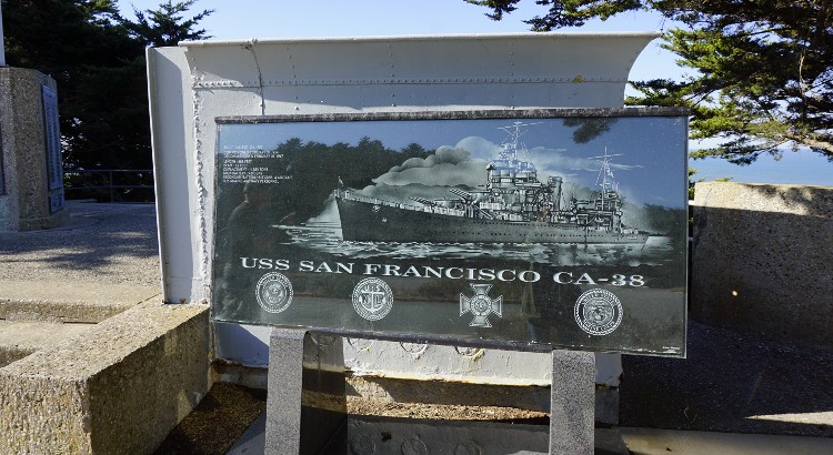
USS San Francisco Memorial: This is a must-see if you are interested in history or have any connection to the military. The memorial is made from the bridge wings of the cruiser damaged in the Battle of Guadalcanal during World War II and honors the sailors who lost their lives. To get here, park at the El Camino del Mar parking lot. You will find the USS San Francisco Memorial steps from the parking lot on its western side.
Fort Miley: This fort was built here in 1899 to guard the entrance to the San Francisco harbor. Very little is left of it except a small building and the overgrown ruins of the West Fort Miley Batteries (Battery Chester, Battery 243, Battery Springer, and Battery Livingston). You can find it by parking at the El Camino del Mar parking lot and taking the dirt path at the south end of the lot. Walk east toward the VA Hospital. The path is only about a half-mile long, and you'll find the old fort and batteries along it.
Octagon House: Only a few Octagon Houses are still standing in San Francisco. You will find one here. You can't visit the interior, but it's cool to see from the outside. It was once a lookout station and is officially called the Marine Exchange Point Lobos Lookout Station. You'll find it at 2500 El Camino del Mar. It's along the same walkway that leads to Fort Miley. Simply take the very first left after you enter the path, and it's at the end.
Legion of Honor Museum: This San Francisco fine arts museum sits in Lincoln Park. Inside, you'll see thousands of pieces of ancient and European art. They span over 4,000 years. In addition to their permanent collection, they also have several wonderful traveling exhibits each year. More about visiting.
Ocean Beach: You will find Ocean Beach just to the south of Lands End. This 3.5 mile-long beach offers a great space to unwind and relax. You will also find surfers during the day and fire pits in action at night. More about visiting Ocean Beach.
Visitor's Center and Lookout Café: You will also find the Visitor's Center (also named the Lands End Lookout) on the southwest corner of this SF attraction. It's a great place to start your walk along the Coastal Trail, check out their maps, and learn more about the area before you begin your adventure. It also has a nice gift shop, so it's a great place to stop after your visit. Park at the Lands End parking lot off Point Lobos Avenue at Merrie Way.
Restaurants Nearby
Here are just a few places to eat nearby.
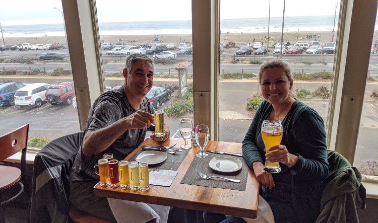
Beach Chalet: This is by far the most famous restaurant in this part of San Francisco. It's south of the building that housed the Cliff House and offers gorgeous views of the waterfront. They serve American cuisine and feature their own brewed beer. More about eating at the Beach Chalet.
Park Chalet: This is in the same building as the Beach Chalet but sits on the ground floor in the back of the building. The views here are of Golden Gate Park and are a great end to your exploration. They also serve up American food and numerous Beach Chalet beers. It's one of my favorites.
Ocean Beach Café: This more casual option serves both lunch and dinner. Their menu is small, but their food is great. You can grab a coffee, a breakfast sandwich, or some avocado toast. For lunch, they offer a salad, a couple of wraps, and a tasty hummus, salsa, and avocado platter. They are proud to have one of the world's first non-alcoholic bars. It's at 734 La Playa Street, just a short walk north of the Beach Chalet. They open from 8 am to 7 pm daily (and until 8 pm Friday through Sunday).
Additional Places to Eat in the Richmond: You will find dozens of other amazing places to eat in the Richmond district, next to Lands End San Francisco. Discover more of my recommendations here.
Note: The Cliff House closed in 2020 and will not reopen. The building is owned by the National Parks Service and they plan to find another restaurant to take its place.
Getting to Lands End
I would recommend taking public transportation. If you plan to visit the western end, your best bet is the 38 or 38R (“R” stands for “Rapid”). It will drop you off at the final stop on this route at 48th Avenue and Point Lobos Avenue. This is also the first stop for those heading east.
You can also take the 1-California to the 32nd and California Street stop. Simply walk north on 32nd Avenue until it ends, and you'll see the eastern trailhead to your left.
Parking at Lands End
If you don’t want to take public transportation, you can always drive to it. You will find lots of parking here. These are just a few of your options.
Merrie Way Lot: I've mentioned this one quite a few times already. It's near the western end and has quite a few spots.
El Camino del Mar Parking Lot: This is a great option and is on El Camino del Mar near Seal Rock Drive.
846 Point Lobos Ave. Parking Lot: This is another lot near the Visitor's Center.
Street Parking: If all of these parking lots are full, you will also find street parking in the neighborhood nearby. I recommend looking along 48th Avenue (just steer clear of the bus stop) and 47th Avenue. Double-check the parking signs around you, as some places offer only 2-hour parking, and you might get a ticket. The hours and details are displayed on signs along the street.
Parking on Lincoln Highway: If you plan to start on the east side, you can also park on the street along Lincoln Highway near 32nd Avenue.
Lands End SF History
Lands End has a long and varied history. Its first inhabitants were the Yelamu Ohlone tribe, who lived in this area for hundreds of years. They used the land for hunting and gathering food.
In 1776, the Spanish began to settle here, which drove out the Native Americans. It remained mostly undeveloped until the US took over California in 1850.
Things were changing due to the Gold Rush. San Francisco's population exploded, and this area became prime for real estate development.
The first Cliff House opened in 1863. It was still quite a distance from SF, so people would come out here on horseback or by buggy and would consider it a day trip.
In the 1880s, ownership changed hands, and Adolph Sutro purchased it. Since it was so far away from downtown, he also added the Cliff House railway from downtown, which ran right along the coastline and partly along the current Coastal trail.
On Christmas night in 1894, a fire tragically destroyed the first Cliff House.
Sutro used the opportunity to redevelop the area and turned it into a waterfront destination. He rebuilt the Cliff House in 1896 and turned it into what looked lick a castle on a rock, a seven-story Victorian Chateau. He also added the Sutro Baths, a museum, a skating rink, and the Sutro Heights Public Gardens.
This second Cliff House burned down in 1907. The current Cliff House opened in 1909 and is a big part of the history of this area.
In 1937, George and Leo Whitney bought the Cliff House, and Sutro Baths. They added Playland-at-the-Beach just to the south, which created an even more exciting destination for locals.
Fewer and fewer people visited the Sutro Baths and they burned down in 1966.
The National Park Service took over in 1977 and turned the area into the Golden Gate National Recreation Area. They still own it today.
Is it Worth Visiting Lands End?
Overall, I think it's worth visiting Lands End San Francisco for those who love the outdoors and history. Its views of the California coast and our iconic Golden Gate Bridge are fantastic.
The wild and windy trail also offers views of the waves crashing below, historic sites, and a great way to get your heart pumping. It's a great place to hike, have a picnic, or just enjoy the incredible views.
Overall, I think it's one of the top things to do when visiting San Francisco.

Hi, I'm Jill!
Dreaming of a San Francisco vacation? As a proud local, I'm here to share my insider tips and personal experiences to help you make the most of this iconic city!
Comments? Questions? Suggestions?
I would love for you to join me in my private Facebook group!
It's a great place to interact with me and others who know the area well.
You can ask questions, get advice for your upcoming stay, and then share your photos and advice with others when you return home. It's a great community and the fastest way to get answers to those nagging questions about your visit!
